Last Friday, 11.10.23, the hiking group went on a more difficult hike with a smaller group of only four people and we explored some canyons on the Hackberry Spring Trail. On this trail are the remnants of one of the last homesteads in this area that, as I understand it, was the site of a massacre of the entire family during the American Indian Wars.


Some of the canyons we explored were over one hundred feet deep!


This is the Hackberry Spring, normally the pipe is flowing full at all times but this year with the extreme heat and dry conditions in Arizona it is just barely trickling water.

These two saguaros form a frame for the mountain in the distance called Four Peaks.

The trailhead sign for Hackberry Springs.

Saturday Cashton and the Flyers Peewee hockey team played in a tournament in Spooner. Marley joined me to cheer the Flyers on!

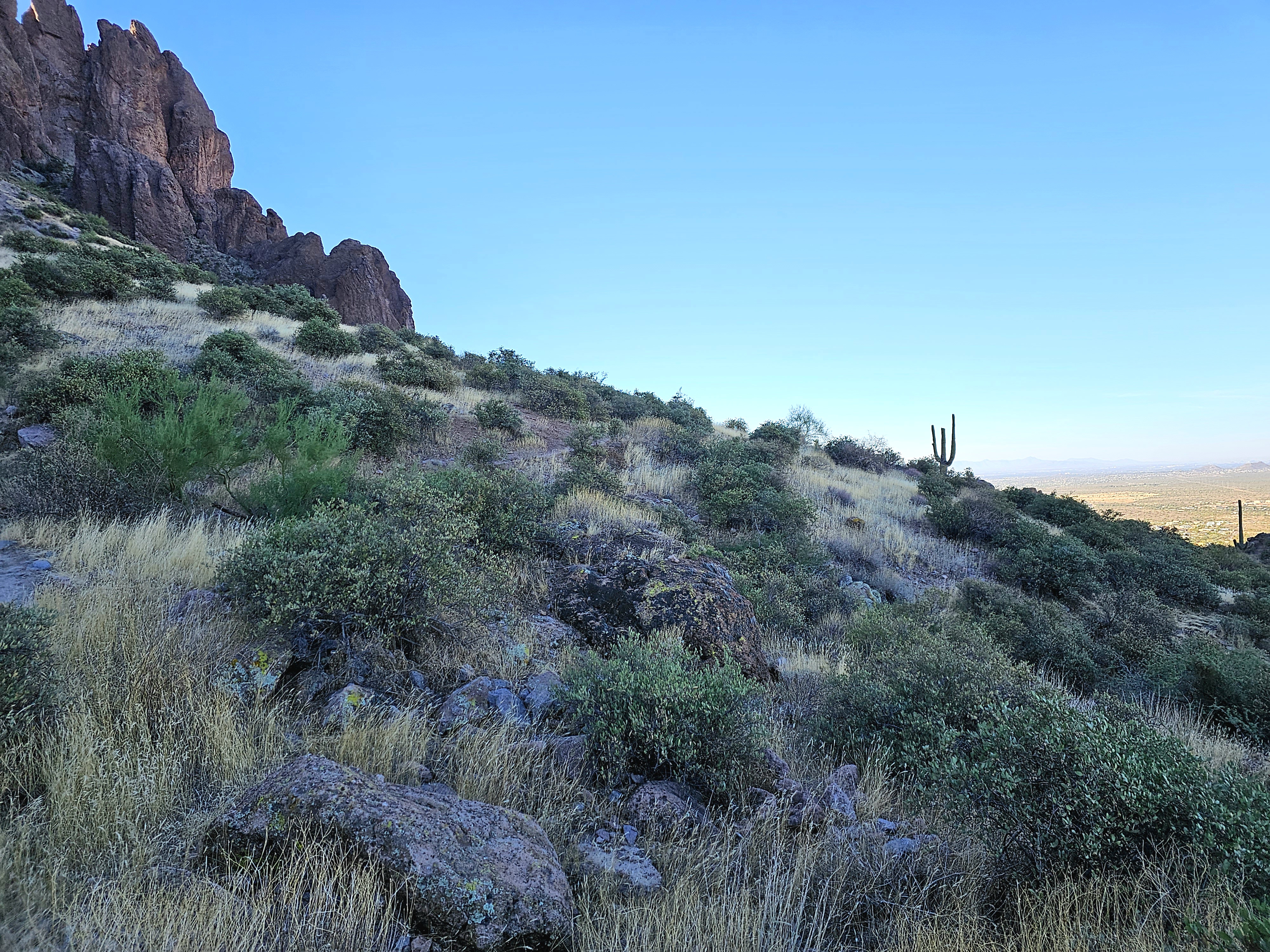
Yesterday, 11.13.23, Colleen and I decided to do a hike on our own at the Lost Dutchman State Park, located in Apache Junction in the Sonoran Desert, 40 miles east of Phoenix. There are several trails that lead into the Superstition Mountain wilderness and surrounding Tonto National Forest. The legend of the Lost Dutchman was that German immigrant Jacob Waltz discovered gold in the Superstition Mountains. To date many people have died trying to find this mine and it is has been named the "lost mine".

We hiked the Treasure Loop Trail (#56): A 2.4 mile round trip, rated a moderate hike, and has an elevation change of 500 feet.

7:30 am...we left the RV Park and arrived at Lost Dutchman about 8:00. It was nice and cool!


Marley walked quite a ways before he pooped out. He did wear his boots! He rode in his backpack the rest of the hike.


Yes, it was a steady climb up toward the base of that mountain.


Getting closer...thank goodness we were on the west side of that mountain and in the shade...until we started coming back down.


At the top we sat and had a snack and a rest. It was beautiful and so quiet!

Heading back down...


Spotted a cave...
Some Apache believe that the hole leading down into the lower world, or hell, is located in the Superstition Mountains.


It was harder going down I think. I slip-slided down some rocks...


We made it all the way... 2.4 miles. My legs hurt.
We left the Lost Dutchman State Park and at the entrance, Al said some day we should go the other way and I said, why not now? So we did...we turned right instead of left.


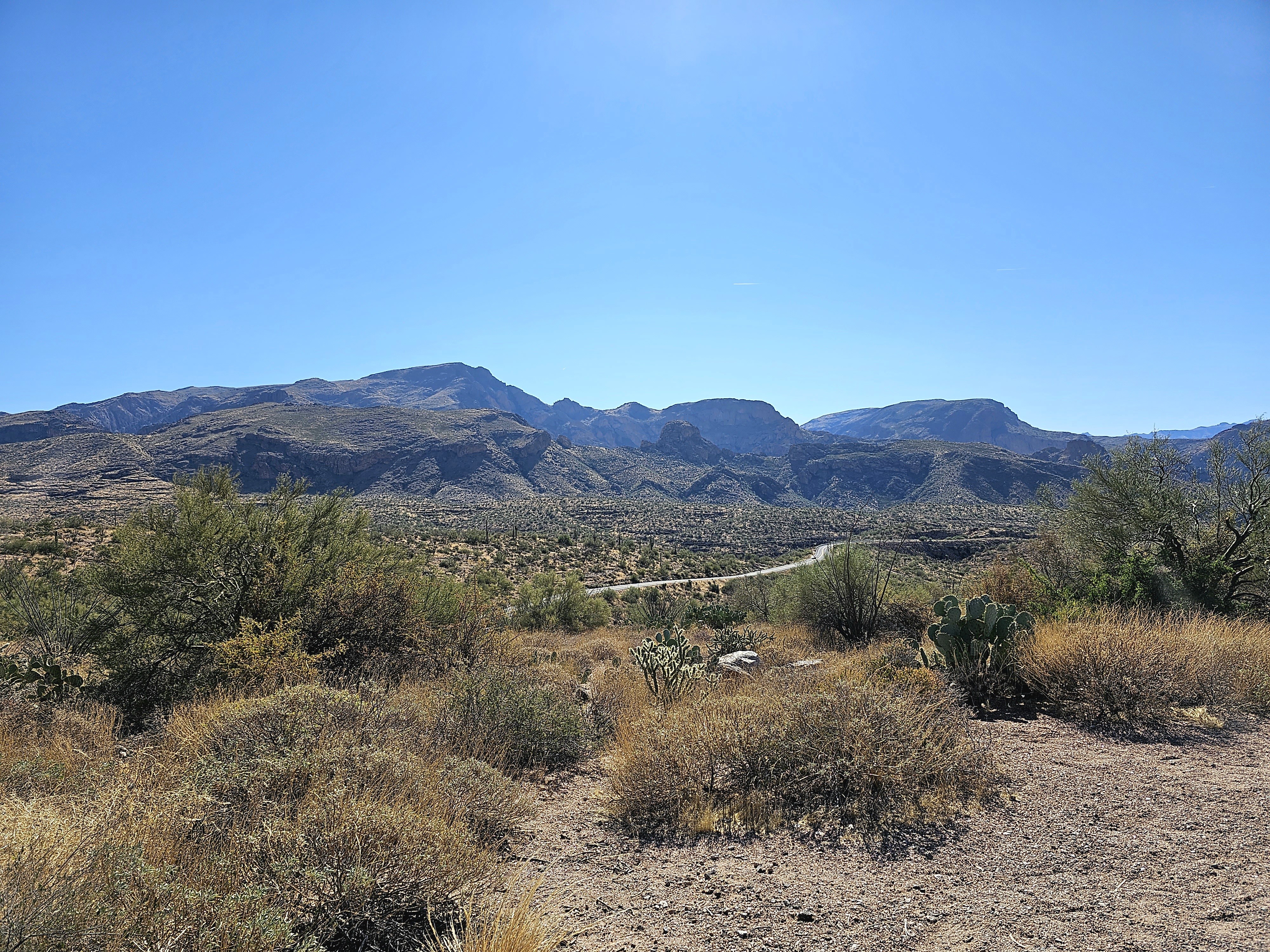
We followed the Tonto National Forest Apache Trail Scenic Drive. WOW! What a beautiful drive!
The trail is 40 miles of desert mountains past deep reservoir lakes like Canyon Lake and Apache Lake. The narrow, winding road is unpaved from just east of the town of Tortilla Flat to Roosevelt Dam; there are steep cliff drops, zero shoulder space and no safety barriers.
From Trip Advisor:
https://www.tripadvisor.com/Attraction_Review-g28924-d212121-Reviews-Apache_Trail_Scenic_Drive-Arizona.html
The existing Apache Trail in Arizona is a 120 mile circle route through the Superstition Mountains. It was named the Apache Trail after the Native American Indians who originally used this trail to migrate through the Superstition Mountains for over 1,000 years. The current Apache Trail links Apache Junction at the edge of the Greater Phoenix area with Theodore Roosevelt Lake, through the Superstition Mountains and the Tonto National Forest. Today, much of the Apache Trail is paved, and the section east of Apache Junction is known officially as State Route 88. It is also the main traffic corridor through Apache Junction, turning into Main Street as the road passes into Mesa, and regains the Apache name by becoming Apache Boulevard in Tempe, ending at Mill Avenue. Prior to the completion of the Superstition Freeway in 1992, the Apache Junction portion of the Apache Trail was part of US Highway 60, which was rerouted to the Superstition Freeway once it was completed. The Trail winds steeply through 40 miles (64 km) of rugged desert mountains, past deep reservoir lakes like Canyon Lake and Apache Lake. The narrow, winding road is unpaved from just east of the town of Tortilla Flat to Roosevelt Dam; there are steep cliff drops and little in the way of safety barriers. The trail requires caution when driving and it is not recommended for large RVs, SUVs, or caravans. Some large RV rental companies in the US do not allow their vehicles to be taken on this route. Originally, and more historically correct, Apache Trail was built as a wagon route for the construction of Roosevelt Dam from 1902-1909 and was originally called the "Mesa to Roosevelt Road." Roosevelt, Fish Creek Station, Tortilla Flat Station, Mormon Flat Flat Station, Pinto Creek and Youngsberg aka Goldfield are just a few of the many historic landmarks along the America's oldest highway, the Apache Trail. As the old Southern Pacific Railroad used to say, "Every mile a scene worth while! Sunshine all the way!"

We also traveled this trail from Show Low to Apache Junction (HWY 60) on our way in to Mesa. We didn't realize we were on a historical scenic trial that day though! That part of the drive was also gorgeous but much scarier because we were pulling Mona behind us!

We stopped at this lake and ate a picnic lunch and Marley dipped his nose in the lake.


We stumbled across this little town and stopped for a treat.
https://www.tortillaflataz.com/
Take a look through the website for some history and some fun reading.

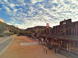
A photo of the town from the internet. There were so many cars and people, I couldn't get one myself.

A photo of the inside of the saloon from the internet. Al and I intend to go back a little earlier in the day and check this out while we are in AZ. You can walk around, take a photo in a jail cell, and check out some history.

YUMMO! Mint-Chocolate Chip Ice Cream.


Well...We ended up on a dead end dirt road with two other cars that were wandering. Turns out that in 2019 there was a fire that burned 125,000 acres of forest. Then in September of 2019 6" of rain came down and washed all the ash and debris into the road. Five miles of road was destroyed. They have reconstructed 3 miles of it but there are two miles left to do. There was a restroom at the dead end and that is where we ended up with the two other cars. In one car was a couple from Eastern Canada who were here for a couple weeks of vacation. They were super nice. Al and the other guy were reading signs and informational plaques. Al was chatting with the woman and she said her husband has to read everything! Al told her that I always say that about him too! The woman introduced Al to her husband as a "fellow reader."
At the same dead-end were two women. One of the women was from the Wisconsin Dells, her husband's name was Eddie, he worked on the road and she mentioned that she used to go to the Eagle Inn in Prairie du Sac and knew Patti Burzynski. She swore she remembered my name too but I have no idea who she was.


The horribly wash-boarded dead end road.

Very curvy and winding! There were 180 degree switchbacks and 90 degree curves...and NO shoulders! The turning radius on Max was not helpful on this road!


We drove and and stopped along the way to enjoy the vista and we stopped to picnic for 4 1/2 hours! Thank goodness I packed a lunch! We enjoyed every minute!

This photo is Al and I. I was playing with a photo editing software.
Next week is Thanksgiving already!
4 comments:
Lots of adventures! How cool that you ran into someone from close to home…what a small world.
Dont get lost in those canyons! And watch out fer da rattlers and scorpions!!! Nice pics and your rosy cheeks! Have lotsa fun!!!
Looks like you are having a great time, but my legs 🦵 hurt thinking of all the walking 🚶♂️ 😕 😢. Happy that you are having a wonderful time. Love you 😍
I really enjoy getting to days off when I can sit down and catch up on your adventures!! Thanks for sharing them with us! Love to you both..
Post a Comment