Leaving Mackinaw City and going to Munising, Michigan to see the
Pictured Rocks National Lakeshore.
Moved to
Christmas MI at the Pictured Rocks RV Park.
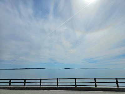
We crossed the Mackinaw Bridge for the last time and one more toll.
There were sand dunes all along the way. It was like driving on a beach in some
places.
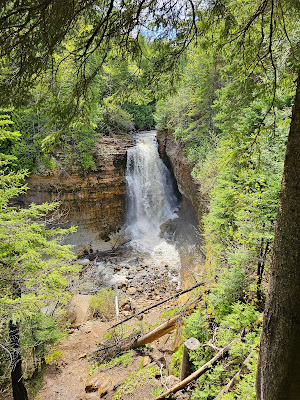
We got set up and went exploring. We went to the Munising Falls Visitor Center and got information. The trail to the falls is closed this year because there is 70 feet of damage to the trail because of a storm. We went to Wagner Falls instead. There was a beautiful boardwalk to the falls. There were huge eroded tree roots that could have trolls living under them or maybe they come alive! We went to Sand Point Beach and to a Pot Store.
25.05.28 Grand Island Overlook
The building itself
was quite beautiful and there was a little history inside. The first bank in
Munising was a tiny space next to a candy store. Payments and deposits were
made through a slot in the front door. The first “real” bank building opened in
1896 with deposits of $15619.00. The sandstone building that stands today was
built in the late 1890s. This building was used as the bank until 1973 when a
new building was built across the street. The first money in this bank was
coinage made of precious metal like gold or silver. It was difficult to carry
enough coin to finance large transactions such as the purchase of large tracts
of land or shiploads of lumber. Paper money was created to represent a value
that the U/S/ Federal Government guaranteed. Silver or Gold Certificated could
be exchanged for equal value of precious metal. Federal Reserve Notes were not
secured by precious metal but rather by the promise of the U.S. Federal
Reserve.
Painted Coves
On the Boat...It was actually called a catamaran.
Lovers Leap...A Native American Legend has it that Lover’s Leap gets its name from an incident when a Native American woman jumped to her death from a steep cliff overhanging the water because her lover failed to return from a trip. The water is only 2 feet deep under the arch.
The Grand Portal
Chapel Rock...has a lone white pine tree perched atop its peak. Estimated to be around 250 years old, it is truly a resilient tree. Chapel Rock once had a natural archway connecting it to the mainland, but it collapsed in the 1940s — leaving the tree stranded on its pedestal.
Its thick roots
still extend out from the rock formation to the main body of cliffs. This
knotted bridge is now a lifeline as the tree’s main source of nutrients and
water.
25.05.29 Information you just want to know!
Lake Superior is
the largest freshwater lake on earth, covering 31,700 square miles. The Ojibwe
people called it Gichigami which means the “Big Sea” or “Huge
Water.” French newcomers gave it the name Lac Superieur or Upper Lake.
Despite its name, Lake Superior acts more like an inland sea rather than a
freshwater lake. It creates it’s own weather and climate and has an insulating
effect on coastal areas.
Lake Superior is
classified as “non-tidal” by the National Oceanic & Atmospheric
Association. Its cyclic fluctuations are not significant enough to be
considered tides. However, Lake Superior does experience seiches. Seiches are
like water sloshing around in a bathtub. When one side of the lake experiences
a storm or change in atmospheric pressure, water levels in other areas of the
lake are effected.
A little history I found interesting...
A lumberjack’s Life
Tall tales of
lumberjacks are many in the north woods but in reality, the logging life was
not easy. The work required men to live away from their families for months at
a time. They would work six days a week from sun up to sun down. Falling trees,
rolling logs and ax wounds were common hazards of the job. Logging camp was
rustic and rowdy—tough bosses were needed to maintain order. After an
exhausting work day, me did little but eat and sleep. Saturday nights were free
for games and music. On Sundays the men took their weekly bath and did laundry.
Bet they smelled real good on Saturday night!
Food was very
important in the logging camp. Lumberjacks needed as many as 9000 calories per
day! Good meals made by a good cook went a long way toward keeping up camp
morale.
Though the job
was difficult and dangerous. It provided one of the few opportunities for
income during the long Upper Peninsula winters.
The invention of
bog wheels in the late 1800s made year-round logging possible. Several logs
suspended by chains under the axle, could be moved without the need for ice.
Big Wheels didn’t sink in muddy or thawing ground which allowed them to be used
even in early spring.
We followed the Log Slide Trail
Miners Falls- .6 mile hike one way. 77 Steps down to the viewing platform. A 40 foot drop.
Chapel Falls- 1.5 mile hike one way
There once was an archway connecting the rock to the mainland. The arch collapsed in the 1940s. The lone white pine on Chapel Rock is estimated to be about 250 years old.
Sable Falls- .5 mile trail. Sable Falls is a 75-foot waterfall cascading down over sandstone formations. The falls are accessible via a short trail and a 168-step staircase, offering great views from the bottom. The trail continues past the falls to a rocky beach on Lake Superior, where Sable Creek empties.
The End of this Blog Post...see I didn't get so carried away with history and facts on this one. 😁


2 comments:
Sherry, looks like a fun adventure!
Looks like this leg of your trip was the best weather. Beautiful pictures 📸💚
Post a Comment